Monday, 25 August 2008

The real final stretch...

Day 18 - Tuesday 19th August: Aviemore to Dingwall.  51.07 miles and 692 metres climbed.
I had planned a longer route today, taking in Grantown, Dava and Nairn but owing to yesterdays efforts into the headwind and the fact the it was raining again, we thought that there was need to be heroic and try to make the passage to Dingwall as short as was possible. That said the other goal was to avoid the A9 as much as possible, which we achieved more or less successfully for the whole ride. The B9153 took us pleasantly, if damply, to Carrbridge, where we turned West, but only to Bogroy which was too short to really appreciate the tailwind. I think it was here that they were holding, in a few days time, their annual 'Chainsaw Sculpture Championship'. One assumes, though the sign doesn't clarify, that the chainsaw in this championship is the tool and not the subject. I didn't dwell on it.
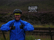
We headed Northwards past Slochd Summit to Tomatin where we had our 90 minute fix beneath the ample shelter of a rather splendid viaduct. Approved. Pressing on (I realise I say that alot but I cant think of any other phrases that describe it as well) we continued to ride along very nice paths and roads that, thanks to the A9, had virtually no traffic. Riding two abreast again we chatted about the various methods and/or merits that line management brings, until Chris spotted that talking about work nowadays brings me out in a panicky sweat. So we reverted to the more usual subject of bikes - and in particular bike clothing. It was agreed that of all my purchases before the trip, my new Endura eVent waterproofs were the outright winners. 
After passing Loch Moy we got a bit lost (or not as it turned out - as we chose the right roads, just without intention). The rain meant we didn't hang around to look at Culloden Battlefield and just headed into Inverness, across the Moray Firth towards Dingwall. The bridge crossing 
was unsatisfactory in that the sides were about 12 inches too low for comfort and given the lovely wind, that was about 12 terrifying inches. We took respite the side in a cafe, for coffee. We didn't speak much. 
We came back off the A9 at the first opportunity and spent the next few miles in the lanes of the Black Isle. I hadn't done any research before the trip as to the history of places, so I have no idea why it's called the Black Isle as it's seemingly neither. In the middle of nowhere we stumbled (honest) across Black Isle brewery. As it was raining all our waterproofs were on which meant our panniers were empty. 6 very large bottles of their finest beers soon put pay to that, and, come to that, our ability to climb hills (a lot of beer, in really weighty glass, really is a bit of a millstone). 
The last time I came to Dingwall was in the early nineties to compete in the Mountain Bike World Cup, so it was a nostalgic last few miles. Even if I didn't recognise anywhere (which, on reflection, might be down to the race actually being in Strathpeffer - just up the road). 
The campsite was next to Ross County F.C - "More than just a football club" apparently. We left without finding out what else it was.

Day 19 - Wednesday 20th August: Dingwall to Wick.  97.09 miles and 1312 metres climbed. 
Well, today represented the last full day, the last big effort before our short little bimble on Thursday into John O'Groats, so it was with mixed feelings that I set off. I was definitely looking foward to completing the adventure, but sad at the same time that it would be over. I was equally sorry that we would not be spending more time with Chris and Jane. Finally, if I'm honest, I was just a tiny bit scared of what things would be like afterwards, as, since giving up work in June, this adventure had given me some focus and purpose. Without that I was worried that I might feel a lack of drive or direction. Perhaps though, that's what having this time off is all about, seeing what makes me tick. 
Anyway.
We decided on a early start and to get breakfast on the fly, which we did courtesy of a delightful little bakery in Alness. If it wasn't Alness it was Evanton but I'm pretty certain it was the former. I plumped for Scotch Pancakes whilst Chris, somewhat surprisingly, opted again for a sausage roll. I didn't get the sense afterwards that he'd be going for a third. 
Without an alternative to the A9 we got some fast, if unspectacular, miles under the belt. Things didn't get better scenery wise until we past (?!@) the Glenmorangie distillery and over the pleasing bridge across the Dornoch Firth. It was also the first time we had seen John O'Groats signposted which brought some excitement. 
The sun was out again today and the wind, whilst North-Easterly (it would be) wasn't too strong - a blessing along this bit of coastline.
We stopped at Evelix for elevenses, then rode a lovely stretch of road around Loch Fleet, The Mound (which for some reason we found quite funny), and along to Golspie. An impressive statue sits atop Ben Bhraggie, not sure what/who of, but you can see it from the Mound (cue sniggers). We stopped at Dunrobin Castle where, quite by coincidence, we met up with Maddie and Jane. It was here apparently that we arranged to meet in Helmsdale, a piece of information that seemed to bypass me, so alas that never happened. Instead, after we rode through Brora and just short of Portgower, Chris and I found a nice patch of grass at the top of a hill - ideal picnic material. 
The early riser in me saw fit to make sandwiches today, which, owing to some fairly stiff climbs earlier, barely touched the sides. On top of this the sun was on our faces, and judging by Chris' ever reclining posture, it appeared he was settling down for the day. I think he may have been a trifle miffed at my urgency to press on but if he was, he didn't mention it. It was also here that we made the decision to extend our ride to Wick, the previous night having decided to cut it short to Dunbeath. It meant another 22 miles but given the weather we thought making hay was the best option. Helmsdale was lovely, as the girls will testify as they had lunch there (alone). After Helmsdale there was an exceptionally long tough climb with two false summits (Tarbets), before we reached Berriedale. It was here that I committed to my last attempt to break 50mph. Well I say committed, I couldn't even be bothered to take my rather unaerodynamic waterproof jacket off - so the fact that I failed and clocked a frustratingly close 49.5mph was pretty much all I deserved. As the momentum carried me up the other side I decided to slow down and wait for Chris (this is not to imply I'm fitter or faster than him, but since his life flashed before him on the Glencoe descent he'd been taking the downhills a bit steadier than me). I wanted to share my frustrations, but it was a tough climb, so I didn't take offence that he chose the breathing option over the chatting one. 
Along this stretch of coastline you'll notice, especially if on a bike, that all the towns are in little valleys, so you always have a nice drop down into them, then usually a far less pleasant climb out the other side. Dunbeath was no different and we stopped at the top (by Inver campsite) to ensure we had enough in our legs to make it to Wick. We hadn't really but were still in the 'better today than tomorrow' zone. Just outside Latheron we spotted a couple of large birds sitting on top of a drystone wall either side of a field. Two eagles. As we clumsily peered over the wall to get a better view, one took flight, and with only a couple of beats of its massive wings, hundreds of rabbits cr@p themselves. 
We took a slight detour into Lybster as we were without liquids. Strange town - eerie. It has two long terraces, separated by an unusually wide road, giving it a bit of a ghosttown feel about it. But the butcher-come-grocer seemed nice - and he wished us luck. 
We spotted Wick on the horizon long before we got there - it seemed to take an age to get there. But we did - and headed straight for the campsite - safe in the knowledge that our extended effort would pay dividends tomorrow. Just 17 miles to John 'Groats. The beer tasted very fine indeed.

FINAL DAY (Day 20) - Thursday 21st August: Wick to John O'Groats (and back) - 17.89 miles / 218 metres climbed (each way).
A very, very special ride. And a pleasure to share with Chris. It felt a bit like wearing the yellow jersey into Paris. I dont remember much about the ride apart from Chris trying not to use his granny ring. I thought a lot about my efforts over the trip, and a lot a bit about my brother. The scenery was unremarkable, (if you dont include the odd castle that appeared now and again) until you reached the summit of the last hill. Here you see, first the Orkneys, and then, below you, the sprawling houses that make up John O'Groats. 
Everything you have heard about the place (which may well be nothing) is true. Nothing much there. What there is is all a bit tacky (though not as bad as Lands End) But I doubt any of that matters to anyone completing this adventure. It's a finish line. I spoke to a family of four whose daughter had downs syndrome - she had done some of the ride on the back of her mums tandem. I heard about a boy who had done it on his skateboard, whilst others have walked it. But I imagine everyone feels more or less the same. A bit sad, quite a bit relieved, very exhausted, quite probably wet, but mainly proud.
Maddie was a rock throughout - deserving of considerably more praise than me (I actually enjoy cycling - imagine pitching and taking down tents every day in all that Britain can throw at you). The charity, Rays of Sunshine, had been excellent, even if they did tend to call you at inconvenient moments (like when you're trying to put on your waterproof bottoms). It was great to share Scotland with Chris and Jane, who both proved able, fun and understanding companions.
Finally I'll thank Roy - for his welcome advice and training tips.  

I'll miss the adventure but some welcome normality awaits.

Now the facts:

I rode 1258 miles (plus the 17 back to Wick)
I climbed 24,466 metres (80,248ft)
I made it (cycling) up every hill.
Longest Day 97.09 miles
Top speed 49.5mph
It rained most days (only one was completely dry)
It rained heavily at least half the days, for most of the day.
Wettest day - Dartmoor
Hardest day - Dartmoor (though the headwind to Aviemore runs it close)
Hardest hill - Hebden Bridge, then Draycott, then Tan Hill, then Buttertubs. Oh and most of Dartmoor and Cornwall.
Best Ride - easily Glencoe, then either side of Hawes, then Snakes Pass.
Best campsite - the ones before a B&B night. Otherwise Castletown or maybe Bowbank. 

Thanks for reading.

John & Maddie.
x

The final stretch...almost

Day 16 - Sunday 17th August: Arrochar - Glencoe.   77.95miles and 1230 metres climbed.
After breakfast Chris and I headed north around the head of the long and quite wide loch to start our ascent of 'Rest And Be Thankful'. Gerry had warned us that this hill was to be feared, so we started the climb (fearfully) in nice low gears and found, gingerly turning each bend waiting for the wall of pain ahead. Four miles later we stood at it's summit, somewhat bemused but certainly without complaint, at it's lack of teeth.  I'm not sure what gave Rest And Be Thankful its name, our best guess was that the thankful bit was that the road doesn't pass over 'Beinn An Lochain'.
The downhill was long and lovely and dropped us down to the shores of Loch Fyne where we resisted the temptations of the distillery (it was a Sunday) and the oyster bar (i mentioned the big breakfast) and headed West along the loch's North shore to Inveraray. Inveraray is, I would boldly suggest, one of the country's prettiest little towns. It's has the air of an unspoilt fishing village, yet with it's own jail, bell tower on top of a mountain, and a castle. With the sun shining I thought it felt a bit Italian, or perhaps Greek, or maybe Portugese but I'm not sure Chris' "hmmnn...maybe" meant that he agreed. We stopped by the church for a sandwich and a powerbar, before bumping into Maddie and Jane - always a pleasure.   
When it became time to leave, we headed North (I'm assuming you've spotted a theme by now) across Glen Ariay towards Dalmally. This actually gave us a much tougher climb than R.A.B.T but the resultant views over Loch Awe with it's beautiful ruined castle (Kilchurn) were spectacular, and worth the unexpected effort. We took the B8074 off of the A85 which was fantastic as it turned out not to be so much of a B road - more of a towpath along a riverbank - and as such pretty much absent of any cars. It was nice to ride two abreast for a change and we made the most and chatted like two old men about what a good stretch of water for fly fishing it looked - a pasttime that I dont think either of us has ever done! But we sounded confident. 
About halfway along the river shallows and widens on a nice bend so Chris and I agreed it was time for elevenses. When I had anticipated a hard day ahead (of which this ticked the box) I'd* been making jam sandwiches (* - that is the royal 'I' - it was actually mainly Maddie). I'm not sure of their nutritional value but they do wonders for an ebbing morale - and they were ritually consumed, as we contently sat on the banks of the River Orchy, surrounded by lovely mountains and with some sun to boot! It took us about twenty minutes to both realise that if jam sandwiches are the preferred snack of the sweaty cyclist, then two sweaty cyclists were the choice brunch for the infamous Scottish midges. So we pressed on, and nice as it was to be riding side by side, the surface (absent of almost any tar) was slow, so it seemed to take an age to get back onto proper tarmac - but that we did at the Bridge of Orchy. 
As we stopped at the pub to call Maddie we saw a couple of cyclists pull in heading in the opposite direction. Likely End2Enders I figured, and we were closer to J.O.G than Lands End I made a concerted effort to ensure they got a good look into my eyes. It was pretty much my best Paddington stare. They hurried into the pub without talking, perturbed I guess by the odd, goggle-eyed bloke outside. I made a note to self not to overdo the 'the look' from here on in. 
After a stiff climb North we passed Loch Tulla, went over an agreeable bridge, before an even tougher climb took us to a seemingly popular vantage point atop 'Black Mount'. Again not black. The view South was a sight to behold but, as it turned out, not a patch on what the next twenty miles were to conjure up. 
As you cross Rannoch Moor, disecting the two lakes there, the vastness of the place starts to become apparent. You almost feel like you've landed on a new, uninhabited planet. But it's as you turn North-Westerly and get your first sights of the 'Heads of Glencoe', that you realise you're somewhere very special. Chris and I descended in silence - except perhaps for the odd "Jeeessssus". I have yet to go to New Zealand but having watched 'Lord of the Rings' a number of times, this was how I imagined it. Two collosal mountains stand magnificent either side of the 'entrance', their opposing slopes smoothly merging into the valley floor making a giant halfpipe. A solitary white house in the middle of the valley completes the picture. This was, by some margin, the most impressive landscape I'd had the pleasure to cycle and it's a ride I will never forget.
If the entrance is dramatic then the 10 mile descent to Glencoe village, is just one big grin, even if my attempt to clock 50mph was thwarted by a slow VW camper. The scenery was a cross between how I imagine Austria (another country I hadn't been to but I had watched 'Heidi') and a scaled up Cheddar Gorge. 
The girls had missed all of this as they had gone to Oban when they left Inveraray to get us some energy drink - so we made them jump in the car and drive it all - the sort of request that rarely turns out to be a good idea - but this time it was. 
The evening was spent in Ballachulish owing to the lack of any eateries in Glencoe (what is it with these places?).

Day 17 - Monday 18th August: Glencoe to Aviemore.  78.53 miles, 793 metres climbed. 
As we left to cross over to Scotlands East coast we were still buzzing from the previous days journey. We were aware that today would be less dramatic (it just had to be), and it was also going to be ridden into the throat of a strong Easterly wind (sods law kicking in again and seeing the wind change direction). But, as ever, we were in good spirits.
We crossed Loch Leven across a moderately likable bridge and then followed the coast of Loch Linnhe towards Fort William, the ridge of mountains to our right providing us with a lovely windbreak. Each time we turned a corner, of which there seemed many, and saw a big mountain we suggested confidently to each other that we were looking at each other. But it was obvious when it was. 
As we left Fort William - a sprawling outdoor boundsy sort of place - we'd been riding for 90 minutes, which meant just one thing - a stop for a pee and a Powerbar. This was a ritual we were not to break. And didn't. In addition the sun was out so the jackets came off (the first time since Cheddar) and we progressed for all of about 22 beautiful bare armed minutes before the sun duly went in and they had to go back on. 
At Spean Bridge we turned onto the A86 and it was here that the wind really started to wear us down. We promised ourselves lunch at 1pm but as I had neglected to make any, we needed to find a shop. At Roybridge Chris spotted a sign that I'd gone straight past - 'last shop for 40 miles'. Nice one Chris. All stocked up we headed off to Loch Laggan, where I stopped for a photo of Adverkerkie ('Glenbogle' for any viewers of 'Monarch of the Glen'). The castle is on the southern shore and we were riding along the tree lined northern one so with no obvious vantage points, I had to climb over the road barrier, through the trees and scramble down a perilously rocky bank to the shore, in order to get a clear view. Anyone who has witnessed someone trying to walk, even on a smooth road, in carbon soled road shoes will be able to picture the somewhat unglamourous descent exactly, anyone who hasn't need only think of a drunk woman in stiletto's trying to cross a cattle grid. That wouldn't be too far off the mark.
When I finally made my way back to dry land, we realised the sensible idea would have been for Chris, in his entirely normal SPD shoes, to take both cameras down. Ho hum - we didn't dwell on the error. 
Lunch followed and consisted of a chicken sandwich, some fruit pastilles (apparently pronounced pasteeeeeels) and a phone call with Mr Littlefield, which mainly centred on Chelsea's more successful start to the new season (than Utd's), and the fact that whilst I had chosen the wettest August for years to cycle the length of the country - he was in Spain, or Portugal (somewhere hot at any rate) kicking back a beer. 
The Adverkerkie Estate is beautiful, and very large - as are many of it's houses. As we reached the Cairngorms National Park, somewhere near Laggan if my memory serves me right, the waterproof bottoms had to go back on (rain). The process of getting these babies on can, at the best of times, challenge your sense of balance, but if you add to the mix my inability to multitask, then you will understand my frustration at having to answer the phone (I know I didn't have to but in my world multi-tasking includes the ability to think and dress). Rather than describe the following scenes just picture the drunk woman again)
We reached Newtonmore at about 3pm - and stopped on exactly the same stretch of pavement chosen by three very well oiled Scottish gentlemen to exit their local. They seemed to say hello - at least that's how my ears heard it - before "progressing" down the road. Their multitasking challenge was seemingly more one of walking and, well, anything really.
We hadn't received confirmation from the girls as to whether Aviemore or Newtonmore was the destination so for a while we were at a loss as to what to do. We didn't feel like riding the 16 miles to Aviemore only to have to turn around. But equally we didn't want to hang around so we decided to press on regardless and not think about the consequences. This we did quickly, through Kingussie, Kincraig all the way to Aviemore. 
The town's economy, much like Fort William's, centres around providing nourishment and expensive (but vital you understand) clothing to all the outdoorsy types. With the absence of any bridges to admire my attention turned to Aviemore's really quite quaint railway station. But we didn't dawdle - as an evening of eating and drinking in a nice (if perhaps overly tartan) hotel awaited.
 

Sunday, 24 August 2008

Anyone know the collective noun for three hapless cyclists?

Day 15 - Saturday 16th August: Ayr to Arrochar (Loch Long). 76.39 miles and and mere 924 metres climbed.
Chris and Jane (our very good friends from Melbourne) arrived safely in Ayr late on Friday night, after touching down in London just a few hours earlier - so were just raring to get going. I did do the right thing and offer Chris the day off - A) because of his jet lag, and B) because of the predicted weather.  He declined, which was just as well as he'd never have squeezed into the little Focus - bless her.  It was great for Maddie and I to have company - what with the lovely weather and all we'd been going a bit stir crazy. Gerry was bang on time, unfortunate really given the amount of faffing we were doing to get Maddie's bike together for Chris. So it was close to 11am before we set off - and for the first few miles I had to get used to riding with people again. 
Our first port of call was Royal Troon Golf Club - sadly not for a friendly three ball - but just a few photos in front of the gates (Chris and I decided to take up boxing stances, as we had done last year for a photo on a beach at Loch-Ard Gorge in Oz, Gerry did something funny with his leg - I didn't ask!). The Focus past us as we set off and seeing Jane's cheery/bleary smile made me glad that Maddie finally had someone normal to keep her company). 
We were quickly through Kilmaurs and Stewarton and heading through the lanes towards the subburbs of South West Glasgow. After Lugton we missed our turning and ended up a tad lost. We ended up riding into a small town in the outskirts which we still dont know the name of - but it had a Bag-Pipe Band playing (I think from Pakistan?!?) and it seemed as good a place as any to stop and eat. Chris was ready to eat a cow but a Greggs sarnie and Sausage roll had to suffice. Not sure if the Australians have particualrly good sausage rolls or ours are particularly poor but Chris was somewhat underwhelmed with regards the quality of sausagemeat on show. 
Crosslee provided us with smooth, freshly laid (we decided to ignore the road closed signs) tarmac so with food in our bellies and some nice macadams the pace picked up and we were soon crossing the Clyde by way of the Erskine Bridge. We stopped to admire the impressive views and the merits of the bridge (that may have just been me). Unfortunately  we had to lose Gerry at this point which was sad, but he had family duties calling so he peeled off and it was left for me and Chris to work out a safe passage to Loch Lomond (the road had turned into a dual carriageway and it seemed everyone was late for something). We couldn't see a safer alternative so just got our heads down and pedalled North. The flipside of defying the rather slim odds was that progress was rapid and the relief that we managed to arrive at the shores of Loch Lomond without joining the hedgehogs, grouse etc amongst the roadkill rank and file, came surprisingly quickly. 
Chris spotted a cycle lane that had been 'laid' along the whole western coastline of the loch. Well, I say laid, essentially it was just a pavement, and at times barely that, but it kept us off the road and gave us a millionaire's view of the all Loch Lomonds finest. We stopped to admire the fairways and greensof Loch Lomond Golf Club - the home of the Scottish Open and apparently the worlds most exclusive course, only to find out we were on 'The Carrick', a poorer (though that is relative) realtion. A few miles later we took some shots of the real thing. At the gates stood two guard dogs. Not real dogs - but two Dark Green Range Rovers. It was clear we weren't to go much closer unless we wanted to see what was at the bottom of the loch, so we quickly continued our passage North. The path runs all the way to Tarbet where we were to peel off West to Loch Long and Arrochar. We reached Tarbet with tired, but miraculously still dry, legs, only to find out there our two Tarbets on the Loch edge, and we were at the first. We later went on to describe a false summit on a climb as a 'Tarbet'. Amusing. 
The second Tarbet was reached with suspicious relief and a short climb lead us to a descent into the pretty village of Arrochar, where we were in the luxury of a B&B. On the descent we passed a riduculous excuse for an RBS branch. 
The views of Loch Long (it is long, and quite wide, but not as wide as it is long) and the looming mountains on the North shore (Beinn An Lochan, The Cobbler and Beinn Narnain) were spectacular, and a bit intimidating as somehow the passage we were to make across them tomorrow was by the infamous 'Rest and Be Thankful'. 
We agreed it was a pity just one night was to be had, despite the absence of decent places to eat. Clearly the B&B was aware of this and laid on the best breakfast (at least in the Northern Hemisphere). 

Saturday, 23 August 2008

Tan Hill - where on earth did that come from!

Day 12 - Monday 11th August: Little Stainforth to Bowbank - 56.58 Miles and 1951 metres climbed.
I think today will rank as one of, if not THE best ride of my life (to date). I had expected great scenery, but what I rode into was really breathtaking (in every sense).
I set of from Stainforth in the usual mix of wind and rain but with spitits high - I was excited about the route today. After my breakfast climb fix I found myself back in Geography fieldtripland, this time courtesy of Selside. God only knows what we did at Selside as there is nothing much there, sheep notwithstanding, but it was nostalgic nonetheless. After a mile or so I approached a T-junction and had my first "oh my god!" moment of the day as I turned a corner and saw Ribblehead viaduct. It stands magnificent to your left at the head of Blea Moor.
As I turned East heading towards Hawes, the road and the scenery to my left continued to give me many of these moments - where I continually let out gasps or just giggled to myself as to how spectacular the views were (cycling on your owns sends you pretty close to the sanity edge ). Climbing up through the remote moors at Far Gearstones then across to High Houses was, so far at least, my favourite stretch of road.
Hawes was very 'James Herriot' and seemingly the home of Wensleydale cheese. For me though it meant the start of the climb that I'd been fearing most - Buttertubs Pass (I know it doesn't sound too fearsome but if you look at a OS Landranger and the see how friendly the contour lines get to each other you'll see why it's scary). My concerns weren't altogether unfounded but, by now, my climbing legs (and/or lungs) were joining me for the trip so I got to the top without too much bother* (*please note that this is relative - too much bother would have been a heart attack or something, and the fact I didn't have one meant I had climbed well!) I stopped at 'Fred's Bench' near the summit to take in the views behind me. If, at the end of my innings, I were to have a bench, then one alongside Freds would suit me fine.
The downhill was fast and winding (new record of 47.8mph) and at the bottom I met another another cyclist who had set off from Catterick. We chatted as we cruised through Thwaite and Keld whilst comparing routes (he hadn't taken on Buttertubs). It turned out we were heading in the same direction for the next stint which I found out when he let out that he "only does Tan Hill once a year". He said this in a very matter of fact manner as if to suggest we both knew what we were in for - but somehow, when I was planning my days ride, it hadn't jumped off the page (perhaps I had been too preoccupied with Buttertubs) so I wasn't expecting another mountain - let alone one as hard as this.
Tan Hill pretty much smacks you straight in the face from the start - with a twisty half a mile of 25%, then it 'flattens' out to 15% for a while before a few more steep bits towards the end kick destroy whatever remaining good feelings you might have had. At the top you find yourself alongside Tan Hill Inn, the UKs highest pub allegedly! The landscape at the summit is a bit like the surface of the moon.
A strong Westerly made my ride down to North Stainmore (a quite desolate place) rather hard and made me nervous of how I would cope in a couple of days time when I was to head West to Dumfries with stronger winds predicted. The rest of the ride was not notable but for the continually amazing views and for the fact that it felt like I had conquered the Dales. I arrived at Bowbank campsite in good spirits but not before I had had my pants scared off me by some jets practising their low valley manoeuvres. Tomorrow I was to head for Kielder, our last day in England.
PS - There was one other notable event on my little pootle from North Stainmore to Bowbank - I had finally passed the halfway point!

Day 13 - Tuesday 12th August: Middleton to Bellingham. 51.54 miles and 1684 metres of climbing.
Miserable. I set off in the rain, finished in the rain and in between the rain only broke twice...for heavy rain! My route was Langdale Beck, across the moors to St Johns Chapel, then Allenheads, Haydon Bridge, Fourstones , Wark then Bellingham.
After a brief detour to take in the somewhat underwhelming 'High Force' (waterfall) I headed to Langdale Beck. As I turned off the main road to cross the moor and climb the west face of Black Hill I spotted a sign. It amusingly reads: "CYCLISTS - This route is liable to poor weather conditions at all times." I'm not sure why it singled out us cyclists in particular and not any other of the poor sods choosing to cross the moor, but it tickled me as pretty much summed up my whole trip so far. The weather had really been comically bad since I left Lands End - though note here that I use the word 'comically' in a way that should not, by any means, be interpreted to mean funny! I chuckled (the sanity edge appearing close again). I pity the next person who jokes "you must have brought the weather with you - it was glorious yesterday!" as I am likely to crack (at all times).
The climb was brutal - really, really punishing. And miserable. Perhaps it was yesterdays efforts but for the first time I was struggling. It wasn't the steepest, the longest or most technically difficult climb - but would make it into the top 3 in all these categories. Apart from that, I didn't notice much today - just a constant battle against the elements and singing to myself to keep the spitits high - generally choosing my (some say uncanny) rendition of Louis Armstrong.
To cap the day off nicely - we had to camp beneath a cluster of pine trees which, after a period of prolonged rain, drip on your tent in a manner not unlike a form of water torture. Perfect.

Day 14 - Wednesday 13th August: Bellingham to Dumfries - 74.77 miles and 1375 metres climbed.
After virtually no sleep, I set off (in the rain in case anyone was wondering) heading towards Kielder Water. I'd ridden these roads a couple of times before when I was younger (and fitter), competing in the Polaris Challenge - a 2 day MTB Orienteering event, which, until this trip, was probably the hardest thing I had done. I rode the South shore of Kielder Water then headed North through Kielder Village - reminiscing the previous rides in these hills - and thinking of some good friendships I had let go of. Clearly the moroseness of yesterday hadn't quite shifted.
But as you cut through the forest between Loch Knowe and Peel Fell you reach the Scottish Border. Just what the doctor ordered. I predictably stopped to photograph the signs - "SCOTLAND welcomes you". For those riding the opposite way England doesn't, it just factually alerts you of it's presence. "ENGLAND".
Within a few hundred metres of crossing the border I was joined in the lane by a dozen or so Swallows - and they accompanied me for about a mile. Whilst this was not the first time in the trip this had happened, (they fly the lanes as it's fruitful hunting grounds for insects - as my frequent spitting fits would validate), it felt very special, as if they were escorting me into the country. A warm welcome indeed.
I quickly reached Newcastleton where I turned off and headed into the hills. The rain was stopping as I reached the top of the pass. The road across the fell ran like a roman road - dead straight across the ridge. A car in the distance gradually got larger, disappearing once or twice as the road occasionally dipped. It was like a scene from an American road movie. I had a break at the top to take in the views, and I noticed I was above the cloud in places, though the cloud was pretty low in fairness.
After a briefish call to Melissa, who let me know all was well in the world of risk management now that I'd left it, I set off, in 'almost' sunshine heading for Malcolm's Memorial on top of a distant hill. It was the first time I'd really noticed the new colours, that had changed from the bleak greys and greens of the Dales to burnt orange and purple heathers. The climb to the memorial was long but steady and the descent, which takes you quickly into Langholm, satisfyingly similar.
I found Langholm to be a pretty town, with very Scottish architecture - the odd house having those coned turrets. I continued West towards Lochmaben via Lockerbie. As I rode past Grange Fell my second avian experience of the day was upon me. I heard a bird of prey above me but couldn't spot it. After about thirty seconds though it glided out above a cluster of trees - an eagle! Not a golden one but an eagle nonetheless. As a child I was a member of the not overly subscribed "Young Ornithologist Club". Blinding.
The sun was out by now so the waterproofs came off at Lochmaben and I rode the last half an hour very happy with the (head) wind on my legs. The ride West hadn't been bad after all - certainly not as bad as I feared when I descended Tan Hill a couple of days earlier - but Maddie had booked a hotel as a precaution anyway and without a jot of guilt (we had desrved this treat after our previous nights of misery) I skipped into town to buy some swim shorts. The evenings triathalon* was a pleasure.

* a 20 minute Spa, followed by 15 minute Steam room, followed by 15 minutes bobbing about in the pool. Repeat until done!

Friday, 15 August 2008

Weather Update ...an area of low pressure from the west seems to be mysteriously following a hapless cyclist North.

Day 10 - Friday 8th August: Castleton to Hebden Bridge. 55.07 Miles / 1475 metres climbed.

My morning hill came courtesy of Bamford today - 1st village, short and sharp. This leads you to Ladybower reservoir where I have it on good authority that 'the Dambusters' practised (the real RAF guys, not the actors). This area was my dads old neck of the woods so it was a pretty special feeling pedalling in his footsteps. After a brief interlude to take some pictures, I proceeded to take on the ascent of Snakes Pass (a long and winding climb over a peak to Glossop). Any cyclists reading this (of which I can only think of my father-in-law Mike) should ride this on a dry day (this was) at least once in their life. Anyone that has (of which I can think of only me) will know why.
At the top of Snakes Pass I stopped to chat to a photgrapher who was working for a bike magazine (proper bikes - not my sort). He was trying to get some action shots of the new Aprilla and Triumph cornering the top few bends - of which they must have ridden over and over at least twenty times. I decided the photographer must have been either fussy, or rubbish. I stopped short of offering any advice! The descent into Glossop was spectacular, and only my desire for some photos disrupted it.
Glossop itself seems to be benefitting from some form of regeneration and was certainly easier on the eye than my preconceptions. From Glossop I skirted the North East of Manchester, via Stalybridge, Mossley, Saddleworth, Uppermill and Delph. The road signs in Delph were confusing by their absence but an ever helpful Postlady set things straight for me and I pressed on towards Denshaw. A fair climb later found me descending towards Hollingworth Lake, which reminded me a little of Frensham Lakes (perhaps lost on most of this audience). From here I joined the A58 and headed once more into the clouds via a somewhat appropriately named village - Summit. This climb reminded me of a Tour climb, in that you can see it meandering upwards from the bottom to what looked like the top (it wasn't) from wherever you were on it.
Once accomplished, the only thing preventing me from a marvellous descent to Hebden Bridge was a Strawberry Cornetto (the climb, I figured, I'd earned the ice cream points).
At this point it's probably worth relaying to you some of Roy's training advice. Prior to me setting off he had posted me 3 suggested training routes all of which finished with the climb of Crockham Hill because, as Roy put it, sods law dictates that whichever route you take, god will throw in a b'stard climb at the end of it (i'm paraphrasing but not much). If ever a ride demonstrated this, then the last 1.3 miles to the B&B at Hebden Bridge does to a tee. It's pretty much 25% the whole way. If I required proof that I completed the climb, then having your wife drive by when you are as close to death as is healthy, should do it nicely.
Maddie normally beats me by a few hours but she had stopped in Glossop for a bit so it now turned into a man vs car race to the finish, just like the Top Gear feature thingys that Jeremy always wins. The car of course won, despite it being stuffed to the brim like an xmas turkley! I was just happy to have completed it, my hardest climb - ever. Our first night in a B&B saw us watching Superstars (our first glimpse of a TV in weeks). The next day would bring rain - again!

Day 11 - Saturday 9th August: Hebden Bridge to Little Stainforth. 40.29 miles / 1119 metres climbed.
Leaving behind the B&B (and their dog, Lucas) was hard as A) it was my favourite overnight stop to date, and B) I was cycling into a severe weather warning. If I hadn't known the difference between the effects of Low and High pressure on the weather before this trip, I certainly did now.
True to form three of the first four miles were spent tackling a predictably tough climb, this one to Oxenhope. The little Focus passed me early todayand I enjoyed watching it for ages, as it disappeared up the hill into the distance, until it dawned on me that if it had taken Maddie that long to get to the top, then things didn't bode well for me. As if to underline this thought, the heavens duly opened.
After a nervous descent took me through Oxenhope and Haworth I just stuck my wet head down, joined the dual carriageway and miserably (but quickly - 20mph ave) progressed through Keighley, Skipton to Coniston Cold. It was here I had a decision to make - either efficiently press on along the miserable main road to the campsite - or heads to the hills of Malham Cove and Tarn.
I had visted Malham Cove et al, on a geography field trip, but I found that 18 years had not changed the place much, even down to the rain and fog. A very steep (but not Hebden Bridge steep) climb takes you North West of the Cove, and across the moors to the Tarn. The fog meant the Tarn was nowhere to be seen again (perhaps the fog had been there since 1989) so I still cant tell you if it's much of an attraction. Despite the abysmal weather, I like riding the moors, and would have stayed up there longer if it weren't for the early signs of pneumonia kicking in. So the sensible thing saw me descend back to the saftey of the tent.
I was content to be halfway into the trip (in days not miles). The next day (a rest one) saw us visit and be a little underwhelmed by Harrogate.

Friday, 8 August 2008

Maddie's Minor Mishaps

Despite the expectations of most that I would take to outdoor living like a duck to water, there have been one or two choice moments in my last week's support duties, and I outline them for you here.
  1. Snapping the elasticated washing line after cunningly tying it to the tent at one end, and the car at the other, then forgetting about it and driving off.
  2. Spending about half an hour in the teeming rain putting up the tent, then having to mop up the inch of water that had accumulated inside with the only dry towel, with every stitch I was wearing soaked through, then having a bird enter the tent and begin cr@pping all over the place. Not my finest hour.
  3. Staggering half blind with tireness after one of the excellent nights sleep, into a conveniently placed shelf in the shower block just below shoulder height, producing a dead arm, a lovely bruise and a 'Fuuuuuuuu....'. There were children present so I contained myself.
  4. Meeting a tractor coming the other way down a lane I had taken in error, that fit only one vehicle. It was suggested by the tractor driver that I reverse into a neighbouring field to let him pass and could I remember to shut the gate. Glad I had the wellies on that day.

Heading North

Day 6 - Monday 4th August: Cheddar, Bristol, Gloucester, Huntley. 64.42 miles, 881 metres climbed.
I wasn't looking forward to today's route too much but it turned out OK. After a bit of a drag uphill to Bristol I stopped under the Clifton Suspension Bridge for some pictures. I think I've discovered an interest in bridges - so much so I've found myself muttering to myself things like "now tell me that's not a nice bridge"!
I then climbed Clifton Downs (a nice area). Good progress owing to the exceptional road surface, I've worked out that it's not just the ratio of tar to macadams but also the size of the macadams that seem critical (small is good!).
So some small macadams and plenty of tar later and I arrived at Forest Gate campsite in Huntley to be greeted by a very chipper campsite owner who was off line dancing but not before selling me a bottle of his finest medium dry for a fiver. There were also a couple of blokes doing the End to End there (North to South), you can tell by their eyes whether they've got less miles to do than you have!

Day 7 - Tuesday 5th August: Huntley, Little Stretton (just outside Church Stretton). 66.17 miles, 1035 metres climbed.
I was looking forward to this one, mainly because the destination was where all my old cycling buddies used to go when I worked at the bike shop (while I generally held the fort at the shop!). Also I'd heard Ledbury and Ludlow were pretty towns, which they are. However I hadn't factored in the Stone Henge sized macamams and the endless convoy of trucks cutting it very close when passing!
Although a damp day, and having to take in a few extra miles after some creative diversions, the spirits remained unbroken.
I met a couple from Horndean (my old neck of the woods), who were doing the trip on their tandem (also N to S). Also a young chap from London who had had to leave his mates behind because they were too slow and he had a deadline! All heading to Lands End and with the now familiar 'nearly finished' look in their eyes. It'll be me soon enough!

Day 8 - Wednesday 6th August: Little Stretton, Telford, Newport, Stafford, Boylestone, Bradley near Ashbourne. 78.98 miles (longest so far), 1358 metres climbed.
I finished climbing Everest today! (somewhere between Gnosall and Uttoxeter). Also clocked my fastest speed so far at 47 mph!
A splendid day, weather good, road surface good, scenery surprisingly good (I had low expectations) and the legs finally returned to form. Leaving Little Stretton I immediately had to climb 'The Wall' (one of the Long Mynd's many climbs). This rewarded me with great views and a lovely long freewheel through to Much Wenlock. A sharpish climb followed, then after a flirt with Telford I headed to Newport and Gnosall.
I stopped here to take some pictures of some canal boats and help a stranded cat. Both missions accomplished I headed onwards through Stafford to Boylestone. Unfortunately the campsite we had earmarked did not meet Maddie's minimum standards so after checking there were enough miles left in the legs we headed further north to Bradley.

Day 9 - Thursday 7th August: Bradley, Bakewell, Chapel-En-Le-Frith, Castleton. 49.59 miles (about 10 miles longer than the routefinder had suggested), 1164 metres climbed.
Well what an agreeable day. Weather good and road surface didn't disappoint. However, it would appear that whichever route I decide to take, the first town of the day always throws a stiff little climb at me first thing. Church Stretton yesterday, Ashbourne obliged today. So muscles and lungs quickly warmed up, I ventured north into the Peak District proper.
Yes, it is as stunning as described. At Newhaven I headed east to Winster (great views), then had probably the best downhill as the (beautifully tarmac'd) road wound north through a forest. I joined the A6 and for two miles passed a traffic jam headed for Bakewell. Bakewell, as well as producing a choice tart, is rather picturesque, so I stopped and windowshopped in some nice jewellers (on the advice of the cheery Huntley campsite owner having witnessed Maddie taking down the tent in the rain - he suggested a bangle style treat for the lady!)
Heading west out of Bakewell was a very long, hard climb, that for some reason reminding me of the days when I was considered 'a bit of a climber'!
Buxton was a bit of an anti-climax, or at least the bit I passed through (dominated by Wetherspoons). Another long climb took me up to Blue John's Cavern (fnarr) and to Mam Tor (known locally as The Shivering Mountain due to the way the light catches it's slopes) - and this one was probably my pick of the day - if I was an American I would be using the word Awesome quite a lot at this point.
A bit of signposting confusion followed, where the apprently correct route didn't have a sign reading Castleton, unfortunately it was a road that seemed to fall off the edge of the world and if it was wrong, and I had to come back up it, I was doomed. There was no choice but to go for it, so I 'dropped in', only to find the world's largest sheep population joining me all over the road. The descent I believe has finally finished off my brake blocks, or what remained of them post Dartmoor, but I didn't kill any sheep, much to the passing tourists' disappointment. At the bottom of the hill a sign welcomed me to Castleton (pity it wasn't at the top to calm my nerves but there you go).
Maddie was sitting serenely (she does that) outside a well erected (it always is) tent to welcome me home. We both agreed it was a pity we couldn't stay here longer, but adventure awaits! Tomorrow sees the back of the Peak District and our first B&B.